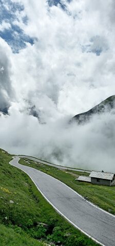
Col d'Agnel links the Queyras valley in France with the Valle Varaita in Italy, topping out on the border at 2744 m, which makes it one of the highest paved passes in the Alps. The canonical French ascent starts at Ville-Vieille, where the road to Agnel leaves the main Guil valley road, and climbs about 20.7 km at a 6.6% average through Molines-en-Queyras and Pierre Grosse. The gradient stiffens in the final kilometres above the tree line, reaching around 13%. The pass has featured in the Tour de France and Giro d'Italia as a Hors Catégorie climb.
Col d'Agnel
2744 m · France
Also: Col Agnel · Col Agnel / Colle dell'Agnello · Colle dell'Agnello
Usually open June–OctoberRoad Paved (D205T on the French side); open in summer, closed in winter.
Open on the map →The 2 sides
| From | Length | Gain | Avg | Max | Cat |
|---|---|---|---|---|---|
| Casteldelfino | 20 km | +1436 m | 7.2% | ≈14.8% | HC |
| Ville-Vieille | 20.7 km | +1368 m | 6.6% | ≈12.1% | HC |
From Casteldelfino
Hors catégorie≈17 hairpin bendsfaces SE
From Ville-Vieille
Hors catégorie≈13 hairpin bendsfaces NW
0–4%4–7%7–10%10–12%12%+
The climb
Race history
2× Tour de France · 4× Giro d'Italia · 1994–2016