Alpine CrownThe great climbs of the Alps All climbs

Zillertaler Höhenstraße

2020 m · Austria

Also: Melchboden

Zillertaler Höhenstraße is a 2020 m road climb in Austria with 2 sides. From Aschau: 16.6 km at an average of 8.8%, climbing 1466 m; the steepest 500 m is about 15.2%. From Hippach: 14.2 km at an average of 10.1%, climbing 1430 m; the steepest 500 m is about 15.3%.

Open
Toll road, usually open May–October
Toll
Only motor vehicles pay. Details ↗

The 2 sides

From Aschau

From AschauHippach2020 m
Start: Aschau im Zillertal · 569 m
16.6kmto the top
8.8%average grade
+1466 m climbingmax ≈15.2%Hors catégorie
100015002000≈14.5%2.5 km≈15.2%10.8 km≈15.0%11.4 km02468101214167.612.712.812.312.912.713.45.62.79.011.611.9-1.26.35.78.34.3km%/km
100015002000≈15.2%10.8 km≈15.0%11.4 km0510157.612.313.49.0-1.28.3km%/km
Bends
≈18 hairpins
Faces
northeast
Every km of the Aschau side
KmFromToGrade
0–1569 m645 m7.6%
1–2645 m772 m12.7%
2–3772 m900 m12.8%
3–4900 m1023 m12.3%
4–51023 m1152 m12.9%
5–61152 m1279 m12.7%
6–71279 m1412 m13.4%
7–81412 m1468 m5.6%
8–91468 m1495 m2.7%
9–101495 m1585 m9.0%
10–111585 m1701 m11.6%
11–121701 m1820 m11.9%
12–131820 m1808 m-1.2%
13–141808 m1871 m6.3%
14–151871 m1928 m5.7%
15–161928 m2011 m8.3%
16–16.62011 m2035 m4.3%

From Hippach

From AschauHippach2020 m
Start: Ramsau im Zillertal · 589 m
14.2kmto the top
10.1%average grade
+1430 m climbingmax ≈15.3%Hors catégorie
100015002000≈15.1%7.0 km≈15.3%9.9 km≈13.6%11.3 km024681012144.59.911.39.310.09.512.57.99.511.311.712.210.511.28.2km%/km
100015002000≈15.1%7.0 km≈15.3%9.9 km024681012144.59.312.511.310.5km%/km
Bends
≈15 hairpins
Faces
southeast
Every km of the Hippach side
KmFromToGrade
0–1589 m634 m4.5%
1–2634 m734 m9.9%
2–3734 m847 m11.3%
3–4847 m940 m9.3%
4–5940 m1040 m10.0%
5–61040 m1134 m9.5%
6–71134 m1259 m12.5%
7–81259 m1338 m7.9%
8–91338 m1433 m9.5%
9–101433 m1547 m11.3%
10–111547 m1664 m11.7%
11–121664 m1786 m12.2%
12–131786 m1891 m10.5%
13–141891 m2002 m11.2%
14–14.22002 m2019 m8.2%
0–4%4–7%7–10%10–12%12%+

The number under each km is its average grade. Flags mark the steepest stretches of about 500 m; the steepest is the max on the sign. Heights come from an elevation model, so grades are approximate.

Open on the map→Navigate ↗
Zillertaler Höhenstraße
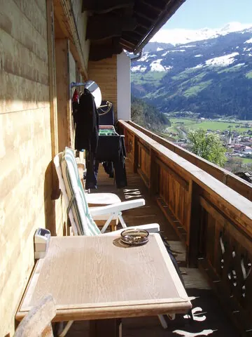
Photo: Juan De Lemos · CC BY-SA 3.0 · Wikimedia Commons

The climb

The Zillertaler Höhenstraße is a tolled panoramic road high on the western flank of the Zillertal in Tyrol.

The ascent from Aschau to Melchboden (~2,020 m) is climbfinder's toughest rated climb in all of Tyrol — about 16 km at over 9%, the first kilometres pitching to 12–21%. No race pedigree: a pure difficulty-and-views classic on quiet toll tarmac.

Source: Wikipedia
Nearby climbs

Zillertaler Höhenstraße2020 m