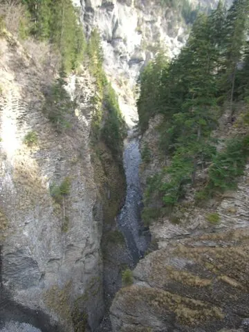
A dead-end climb from the Rhône valley at Sion up to the Lac de Tseuzier, a reservoir held by the Rawil (Zeuzier) dam at roughly 1,780 m, below the Wildhorn.
Lac de Tseuzier
1778 m · Switzerland
Also: Tseuzier · Barrage du Rawil · Zeuzier
Lac de Tseuzier is a 1778 m road climb in Switzerland. From Sion: 20.1 km at an average of 6.2%, climbing 1251 m; the steepest 500 m is about 9.9%.
- Open
- Dead-end reservoir road; ride late spring–autumn
- Webcam
- Tseuzier dam ↗ at the top
The side
From Sion
From Sion1778 m
Start: Sion · 527 m
20.1kmto the top
6.2%average grade
+1251 m climbingmax ≈9.9%Hors catégorie
- Bends
- ≈10 hairpins
- Faces
- southwest
- Lights
- Front and rear. 1 tunnel (630 m).
Every km of the Sion side
| Km | From | To | Grade |
|---|---|---|---|
| 0–1 | 527 m | 589 m | 6.2% |
| 1–2 | 589 m | 679 m | 9.0% |
| 2–3 | 679 m | 747 m | 6.8% |
| 3–4 | 747 m | 816 m | 7.0% |
| 4–5 | 816 m | 882 m | 6.5% |
| 5–6 | 882 m | 899 m | 1.7% |
| 6–7 | 899 m | 950 m | 5.1% |
| 7–8 | 950 m | 970 m | 2.0% |
| 8–9 | 970 m | 1023 m | 5.3% |
| 9–10 | 1023 m | 1069 m | 4.6% |
| 10–11 | 1069 m | 1135 m | 6.6% |
| 11–12 | 1135 m | 1148 m | 1.3% |
| 12–13 | 1148 m | 1230 m | 8.2% |
| 13–14 | 1230 m | 1326 m | 9.6% |
| 14–15 | 1326 m | 1419 m | 9.3% |
| 15–16 | 1419 m | 1508 m | 8.9% |
| 16–17 | 1508 m | 1593 m | 8.5% |
| 17–18 | 1593 m | 1679 m | 8.6% |
| 18–19 | 1679 m | 1763 m | 8.3% |
| 19–20 | 1763 m | 1774 m | 1.2% |
| 20–20.1 | 1774 m | 1778 m | 3.0% |
0–4%4–7%7–10%10–12%12%+
The number under each km is its average grade. Flags mark the steepest stretches of about 500 m; the steepest is the max on the sign. Heights come from an elevation model, so grades are approximate.