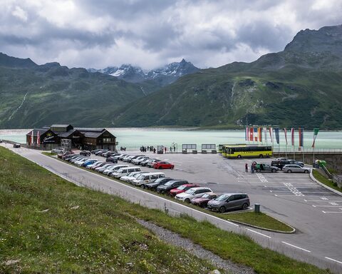
The Bielerhöhe is the high point of the Silvretta-Hochalpenstraße, a toll road opened in 1954 that links the Montafon valley in Vorarlberg with the Paznaun valley in Tyrol. From Partenen the western ascent climbs through more than 20 hairpin bends past the Vermuntsee toward the Silvretta reservoir just below the col. The road is closed in winter and normally operates only from early June to late October. After rockslides in 2024 the Vorarlberg side was closed for major repairs, with through-passage expected to reopen around 2030; the col itself stays accessible from the Tyrolean side.
Bielerhöhe
2037 m · Austria
Also: Silvretta Hochalpenstraße
Usually open June–OctoberRoad Silvretta-Hochalpenstraße (toll road)
Open on the map →The side
| From | Length | Gain | Avg | Max | Cat |
|---|---|---|---|---|---|
| Partenen | 14.2 km | +990 m | 7% | ≈13.4% | HC |
From Partenen
Hors catégorie≈28 hairpin bendsfaces N
0–4%4–7%7–10%10–12%12%+