Alpine CrownThe great climbs of the Alps All climbs

Großglockner Hochalpenstraße

2563 m · Austria

Giro d'Italia2× · 2 summit finishes1971–2011

Großglockner Hochalpenstraße is a 2563 m road climb in Austria with 2 sides. From Fusch: 19.4 km at an average of 8.9%, climbing 1719 m; the steepest 500 m is about 13.6%. From Heiligenblut: 15.7 km at an average of 8%, climbing 1258 m; the steepest 500 m is about 13.1%.

Open
Usually open May–October
Toll
Free for cyclists. Optional accident insurance: €4 a day at Ferleiten. Details ↗

The 2 sides

From Fusch

Start: 849 m
19.4kmto the top
8.9%average grade
+1719 m climbingmax ≈13.6%Hors catégorie
1000150020002500≈12.4%5.1 km≈13.6%13.8 km≈12.9%18.2 km0246810121416187.37.33.311.09.110.58.89.19.311.2km%/km
1000150020002500≈13.6%13.8 km≈12.9%18.2 km0510157.34.711.08.48.89.611.2km%/km
Bends
≈26 hairpins
Faces
north
Every km of the Fusch side
KmFromToGrade
0–1849 m922 m7.3%
1–2922 m1018 m9.6%
2–31018 m1091 m7.3%
3–41091 m1138 m4.7%
4–51138 m1171 m3.3%
5–61171 m1277 m10.6%
6–71277 m1388 m11.0%
7–81388 m1485 m9.8%
8–91485 m1577 m9.1%
9–101577 m1661 m8.4%
10–111661 m1766 m10.5%
11–121766 m1859 m9.3%
12–131859 m1947 m8.8%
13–141947 m2065 m11.8%
14–152065 m2156 m9.1%
15–162156 m2252 m9.6%
16–172252 m2345 m9.3%
17–182345 m2423 m7.8%
18–192423 m2535 m11.2%
19–19.42535 m2568 m9.4%

From Heiligenblut

Start: Heiligenblut · 1247 m
15.7kmto the top
8%average grade
+1258 m climbingmax ≈13.1%Hors catégorie
150020002500≈11.8%3.5 km≈13.1%6.4 km≈12.5%14.5 km024681012145.510.210.09.88.48.711.5-2.3-0.57.79.29.610.310.010.49.6km%/km
150020002500≈13.1%6.4 km≈12.5%14.5 km0510155.59.811.57.710.39.6km%/km
Bends
≈13 hairpins
Faces
south
Every km of the Heiligenblut side
KmFromToGrade
0–11247 m1302 m5.5%
1–21302 m1404 m10.2%
2–31404 m1504 m10.0%
3–41504 m1602 m9.8%
4–51602 m1686 m8.4%
5–61686 m1773 m8.7%
6–71773 m1889 m11.5%
7–81889 m1866 m-2.3%
8–91866 m1861 m-0.5%
9–101861 m1938 m7.7%
10–111938 m2030 m9.2%
11–122030 m2126 m9.6%
12–132126 m2229 m10.3%
13–142229 m2329 m10.0%
14–152329 m2433 m10.4%
15–15.72433 m2505 m9.6%
0–4%4–7%7–10%10–12%12%+

The number under each km is its average grade. Flags mark the steepest stretches of about 500 m; the steepest is the max on the sign. Heights come from an elevation model, so grades are approximate.

Open on the map→Navigate ↗
Großglockner Hochalpenstraße
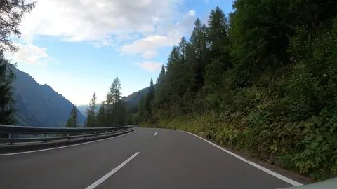
Photo: osmplus_org · CC BY-SA 4.0 · Wikimedia Commons

The climb

The Grossglockner High Alpine Road is the highest surfaced mountain pass road in Austria, connecting Bruck in Salzburg with Heiligenblut in Carinthia via the Fuscher Törl (2,428 m) and the Hochtor Pass (2,504 m).

It was built over four years from 1930 and opened on 3 August 1935, originally as a 3-metre gravel road and later widened and paved; a 1.5 km branch — its final ramp cobbled — reaches the Edelweißspitze viewpoint at 2,571 m. It featured in the Giro d'Italia in 1971, where it was the first Cima Coppi located outside Italy, and again in 2011.

Source: Wikipedia

Race history

Giro d'Italia2×

2 passages, 1971 to 2011

Up: from FuschDown: from Heiligenblutfinish up here

Grand Tours only
Every passage
  1. 1971 · Giro d'Italia · from Fusch · the stage finished up here
  2. 2011 · Giro d'Italia · from Heiligenblut · the stage finished up here

Nearby climbs

Großglockner Hochalpenstraße2563 m